wikiHow is a “wiki,” similar to Wikipedia, which means that many of our articles are co-written by multiple authors. To create this article, 40 people, some anonymous, worked to edit and improve it over time.
This article has been viewed 132,220 times.
Learn more...
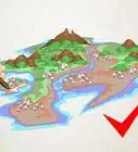
Drawing a map of the United States of America is harder than it looks. However, you can practice and get it right. While you see states that are basically rectangles like Colorado and Wyoming, you can't forget states such as Maryland and West Virginia.
Drawing the map of the United States of America almost perfectly is challenging and tricky. However the reward of making a comprehensive map goes beyond the efforts put into it. Read on to better your skills in making a good map of the USA.
Steps
-
1Learn about certain projections and maps. All projections will have some degree of distortion.
- The Mercator Projection is a mathematical projection that stretches out area to an infinite factor at the poles. While this projection displays areas near the equator accurately, there is an extreme amount of distortion near the poles. It is recommended to draw from this projection as the United States sits below the 50°N latitude where distortion gets really high.
- The Winkel Triple Projection is a compromise projection designed to view the entire world with minimal distortion. This is not a good projection to draw from as the longitude of the USA is too far from the Prime Meridian to have an accurate drawing.
- The Albers conic equal-area projection is a projection designed to conserve land area and shape. This is one of the best maps to draw from as it gives an accurate shape of the United States, and is most familiar with the general public. Just remember that the grid lines are not perfectly horizontal or vertical.
-
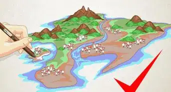
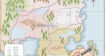
2Understand the four different maps. The four are political, physical, thematic, and cartograms. For now, you do not have to worry about cartograms.
- Political maps will include:
- Borders
- Names of cities, capitals, and their locations
- Roads (major highways)
- Physical maps will include:
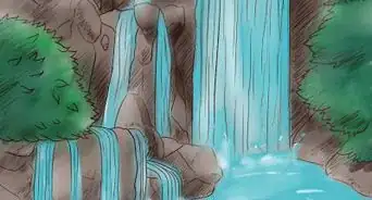
- Geographic data (mountains, valleys, waterfalls, rivers, etc.)
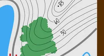
- Elevation (usually denoted in color - green being low, brown high) - sometimes, a legend, or key, is used.
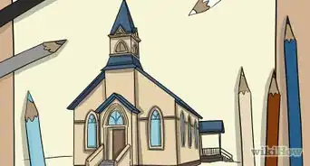
- Landmarks
- Thematic maps will be different. Instead of the usual thing, thematic maps depend on special characteristics, such as vegetation, oil consumption, urban density, climate differences, etc. A legend is going to be needed, as the map will almost certainly be colored to differentiate different areas.
Advertisement - Political maps will include:
-
3Comprehend famous landmarks. An example is the highest mountain in that state.
-
4Identify the projection you are going to use to draw your map. Maps of the United States on the Internet is a fine source, instead of having to buy it.
-
5Think about size. The more you zoom into the USA, the more details you will have to fill in. This is very important for drawing the USA as a whole, because even a minor blemish or streak here and there can significantly impact shape.
-
6Recognize the shapes of all 50 states. While some states are literally just rectangles (e.g. Wyoming and Colorado), you can't forget states such as Maryland and West Virginia. Thus, it would be reasonable to practice tracing some of these states first, then put on the main map. A table of land area and a map of the state is useful.
-
7Attempt a rough sketch of the outline of the country and the states. You don't have to fill in every necessary detail, but just a generalization of what the state will look like. This would be better than to start blindly, than to have a generalization. Since starting at the nooks and crannies right away usually would distort most maps, it is not recommended to start along that route.
-
8Go into more detail. This does not mean that you draw the USA over and over again. It also does not mean to erase it over and over again and draw it. Rather, divide the places you are having trouble with and analyze the detail. Some examples are coastlines and rivers. Although not needed, it may be helpful to take notes about what goes here and there and such.
- When you draw thematic maps, do not draw any artificial islands, oil rigs locations, or similar things, unless it is specified in your legend. Unnecessary information can confuse the reader, even in maps - not just books.
- It is good if you plot or find out routes of major rivers that impact on state shapes. Some examples are the Mississippi, Missouri, Colorado and the two Red Rivers (Oklahoma/Texas and North Dakota/Minnesota). Since rivers impact shapes of the USA, especially in the eastern region, it significantly helps improve shape and reduces distortion.
- Remember about Alaska and Hawaii. Although technically not in the Lower 48, they are still part of the USA, and thus needs to be included in your map. Many versions of maps made by computers have Alaska and Hawaii at the lower left corner of the paper, where Mexico shares its border with the USA. You may also wish to put them on a separate sheet of paper.
-
9Draw your final using a pencil. A regular #2 pencil is fine, but serious sketchers may use a sketchers kit with 10 different pencils of all shades. This should include the following:
- Color - very important for drawing maps of all kinds. On a political map, it is wise to choose colors that contrast with each other, and to not color in two bordering states with one color. That way, it will reduce confusion.
- All features of the physical map - explained above. Only do this if you are drawing a physical map.
- It is possible to color in a hybrid of political and physical. Colored pencils prevail over other methods of coloring as the map will be crowded. This will require borders, cities and capitals, and physical features. Color from the physical, not political map, will be used.
- Thematic map: the data of your choice with a legend and color accordingly. Even though you will have to research on the internet or find out data from books, it is still a brilliant achievement to have drawn the USA, instead of copying and pasting.
- A marker (dark colors preferred) - this is to clarify borders and to make it stand out. Without the marker, contrast would be low.


Community Q&A
-
QuestionHow do I draw just California's outline?
 Community AnswerFind an image on Google, then trace it, then color it, label it, do whatever needs to be on there and then you're done!
 -
QuestionHow do I draw the map of the U.S.A. with grid lines and symbols of rivers?
 Community AnswerDraw the outline of the countries and divide the inside into 50 parts. Use squiggly lines for the rivers. You don't have to put every river; just the ones that are important and big.
 -
QuestionHow can I draw a perfect picture of the east coast of America without messing up or going off the page? It's for a report I have to have done soon.
 Community AnswerGet a picture online or a map that's the right size, and then trace it. If you're using an online photo, make sure it's proportional.
Things You'll Need
- A lot of scratch paper
- Pencils with erasers
- A map of the USA that was made by a computerized projection
- Permanent or washable marker
- Watercolors, crayons, markers, or any kind of thing that you can use to color