This article was co-authored by wikiHow staff writer, Johnathan Fuentes. Johnathan Fuentes is a writer based in the New York City region. His interests as a writer include space exploration, science education, immigration, Latinx cultures, LGBTQ+ issues, and long-form journalism. He is also an avid hiker and has backpacked in Alaska and Newfoundland, Canada. A son of Cuban immigrants, he is bilingual in English and Spanish. Prior to joining wikiHow, he worked in academic publishing and was a freelance writer for science websites. He graduated from Columbia University in 2021, where he studied nonfiction writing and wrote for the student newspaper. He is currently counting down the seconds until the release of Kerbal Space Program 2 in 2023—a game that will almost certainly take up what little free time he has.
There are 8 references cited in this article, which can be found at the bottom of the page.
wikiHow marks an article as reader-approved once it receives enough positive feedback. In this case, several readers have written to tell us that this article was helpful to them, earning it our reader-approved status.
This article has been viewed 589,266 times.
Learn more...
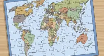
If you’ve ever read a map or a globe, you’re probably familiar with latitude and longitude. These coordinates can you help you pinpoint your exact location on Earth—but how do you write them? There are a few different methods for this, and with a little practice, they’re all easy to learn. This guide will teach you the four most common ways to write latitude and longitude. We’ve also thrown in some tips to help you understand how these coordinates work, plus instructions for finding latitude and longitude using globes, paper maps, and even modern software like Google Maps.
Things You Should Know
- Latitude and Longitude are written as two numbers. The numbers can be written in degrees, minutes, and seconds, (plus N, S, E, W), or in decimals degrees.
- Latitude indicates how far North or South a point is from the equator, while longitude indicates how far East or West a point is from the Prime Meridian.
- Each degree divides into 60 minutes, and each minute divides into 60 seconds. For example, 40°45'11"N is “40 degrees, 45 minutes, and 11 seconds North.”
- For example, New York City’s coordinates in degrees, minutes, & seconds are 40°45'11"N, 73°58'59"W—or 40.753056, -73.983056 in decimal degrees.
Steps
Writing Basic Latitude and Longitude
-
1Identify lines of latitude. Lines of latitude run East to West, starting with the 0° line—a.k.a., the equator. Each line is labeled in degrees, followed by “N” for “North” or “S” for “South.” Lines to the North of the equator 0° will be labeled with an “N,” while lines to the South of the equator will have an “S.” The number of degrees increases as you move farther North or South of the equator.[1]
- For example, New York City is located close to latitude line 40°N. This means that New York City is 40 degrees North of the equator.
- Sydney, Australia, is located near the latitude line 34°S. This means that Sydney is 34 degrees South of the 0° equator.[2]
- Latitude lines range from 0°-180° North or South. Since 0° (the equator) sits exactly between the Northern and Southern hemispheres, 0°N and 0°S mean the same thing.
- 180°N is the geographic North Pole, while 180°S is the geographic South Pole. Since these are different locations, 180°N and 180°S are not the same.
-
2Identify lines of longitude. The lines run North to South, beginning with the 0° longitude line located near London, U.K. Each line is labeled in degrees, followed by an “E” for “East” or a “W” for “West.” Lines to the East of 0° will be labeled with an “E,” while lines to the west of 0°will have a “W.” The number of degrees increases as you move farther East or West of 0°.[3]
- For example, New York City is located close to the longitude line 74°W. This means that New York City is 74 degrees west of the 0° longitude mark.
- Sydney, Australia, is located near the longitude line 150°E. This means that Sydney is 150 degrees east of the 0° longitude mark.
- The 0° longitude mark is called the prime meridian. Since it’s located exactly in between the Eastern and Western hemispheres, 0°E and 0°W mean the same thing.[4]
- The opposite line, 180°, runs North to South in the middle of the Pacific Ocean. As with 0°, 180°E and 180°W mean the same thing since the 180° line is located exactly between the Western and Eastern hemispheres.
Advertisement -
3Write the latitude and longitude coordinates of a specific location. The coordinates are always written with latitude first, followed by a comma, followed by longitude. For example, the latitude and longitude of New York City are roughly 40°N, 74°W. For Sydney, the coordinates are roughly 34°S, 150°E.[5]
- Your latitude and longitude won’t be exact when using a map or globe. For example, your map or globe may only show degrees in increments of 5° (that is, 40°, 45°, etc.). Use Google Maps to obtain more precise coordinates.
- For this exercise, you can use the latitude or longitude line nearest to the location you’re measuring. So for New York City, your coordinates might be 40°N, 75°W.


Using Degrees, Minutes, and Seconds
-
1Use Google Maps to find the latitude and longitude of a specific location. Choose a specific city or location, then tap or right-click to read the latitude and longitude. Your coordinates will have decimal numbers after them. These will get converted to “minutes” and “seconds,” which are fractional portions of a degree.[6]
- On Google maps, your latitude and longitude will be displayed as positive or negative numbers, but no compass direction (that is, no N, S, E, or W). A positive latitude is East, while a negative latitude is West. A positive longitude is North, while a negative longitude is South.
- For example, New York City’s coordinates on Google Maps are roughly 40.753, -73.983. This means 40.753°N, 73.983°W.[7]
-
2Multiply decimal parts of your degrees by 60 to convert them to minutes. Each degree is divided into 60 minutes, or 1/60 of a degree. Multiplying the decimal parts of your latitude and longitude by 60 gives you the number of minutes represented by the decimal. The minutes are written with an apostrophe. For example, 8 minutes would be written as 8'.[8]
- Let’s use New York City’s coordinates as an example: 40.753°N, 73.983°W. For latitude, the decimal part is .753. For longitude, the decimal part is .983.
- .753 x 60 = 45.18 minutes, written 45.18'.
- .983 x 60 = 58.98 minutes, written 58.98'
-
3Multiply decimal parts of the minutes by 60 to convert them to seconds. Each minute can be further divided into 60 seconds, or 1/60 of a minute. Multiplying the decimal parts of the minutes by 60 gives you the number of seconds represented by the decimal. The seconds are written with two apostrophes. For example, 17 seconds would be written as 17".[9]
- Let’s use New York City’s coordinates with minutes as an example: 40° and 45.18' North for latitude, and 73° and 58.98' West for longitude. For latitude, the decimal part of the minutes is .18. For longitude, the decimal part of the minutes is .98.
- .18 x 60 = 10.8, or roughly 11 seconds. This is written as 11".
- .98 x 60 = 58.8, or roughly 59 seconds. This is written as 59".
-
4Write your latitude and longitude degrees, minutes, and seconds. After finding the precise coordinates in minutes and seconds for a specific location, write them out in the correct order. Start with your line of latitude, writing the degrees, minutes, and seconds. Add an N (for North) or S (for South) as the direction. Then, write a comma followed by your line of longitude in degrees, minutes, and seconds, adding an E (for East) or W (for West) as the direction.[10]
- For New York City, the latitude is 40 degrees, 45 minutes, and 11 seconds North. The longitude is 73 degrees, 58 minutes, and 59 seconds West.
- Therefore the latitude and longitude of New York City are written as 40°45'11"N, 73°58'59"W.


Using Degrees and Decimal Minutes
-
1Use Google Maps to obtain the latitude and longitude. Pick a city or specific location, then tap or right-click to view the latitude and longitude. The coordinates will have decimal numbers after them. You’ll convert these decimals to “minutes,” which are fractions of a degree.[11]
- On Google maps, latitude and longitude are displayed with positive or negative numbers. They won’t have a compass direction (that is, they won’t have N, S, E, or W). A positive latitude is East, while a negative latitude is West. A positive longitude is North, while a negative longitude is South.
- For example, Sydney, Australia’s coordinates on Google Maps are roughly -33.868, 151.214. This means 33.868°S, 151.214°E.
-
2Multiply decimal parts of the degrees by 60 to convert to minutes. Each degree on a map is divided into 60 minutes, or 1/60 of a degree. To calculate the number of minutes represented by the decimal parts of your latitude and longitude, multiply the decimal parts by 60. The minutes are written with an apostrophe. For example, 37.44 minutes would be written as 37.44'.[12]
- Let’s use Sydney, Australia’s coordinates as an example: 33.868°S, 151.214°E. For latitude, the decimal part is .868. For longitude, the decimal part is .214.
- .868 x 60 = 52.08 minutes, written 52.08'.
- .214 x 60 = 12.84 minutes, written 12.84'.
-
3Write your latitude and longitude in degrees and minutes. After finding the precise coordinates in degrees and minutes for a specific location, write them out in the correct order. Start with your line of latitude, writing the degrees and minutes. Add North or South as the direction. Then, write a comma followed by your line of longitude in degrees and minutes, followed by East or West for the direction.[13]
- For Sydney, Australia, the latitude is 33 degrees and 52.08 South. The longitude is 151 degrees and 12.84 minutes East.
- Therefore the latitude and longitude of Sydney, Australia in decimal minutes are 33°52.08'S, 151°12.84'E.
Using Decimal Degrees
-
1Use Google Maps to find the latitude and longitude of a specific location. Choose a specific city or location, then tap or right-click to view the latitude and longitude. Your coordinates will be displayed in decimal minutes, without N, S, E, or W.[14]
- For example, your coordinates could be 15.23456 and 30.67890.
-
2Identify whether numbers are positive or negative. Rather than using North, South, East, and West, positive or negative numbers are used. For lines of latitude, lines North of the equator are positive while lines South of the equator are negative. For lines of longitude, lines East of the Prime Meridian are positive while lines West of the Prime Meridian are negative.[15]
- For example, the line of latitude 15.23456 is north of the equator, while the line -15.23456 is south of the equator.
- The line of longitude written as 30.67890 is east of the Prime Meridian, while the line -30.67890 is west of the Prime Meridian.
-
3Write latitude and longitude, including decimals. For decimal degrees, simply write out the line of latitude, including decimals, followed by the line of longitude, including decimals. Use positive or negative numbers to indicate direction.[16]
- For example, if your coordinates are 15.23456 degrees north and 30.67890 degrees West, you would write them as "15.23456, -30.67890."
- For decimal degrees, you do not need to write the degree symbol.


Community Q&A
-
QuestionAre the digits to the right of the decimal point minutes and seconds respectively?
 Community AnswerUsually if you see format 12.345678°, this is not minutes and seconds, but decimal degrees.


References
- ↑ https://manoa.hawaii.edu/exploringourfluidearth/physical/world-ocean/locating-points-globe/compare-contrast-connect-converting-decimal-degrees
- ↑ https://www.google.com/maps/place/33°52'14.4"S+151°12'56.9"E/@-33.8706611,151.213616,17z
- ↑ https://manoa.hawaii.edu/exploringourfluidearth/physical/world-ocean/locating-points-globe
- ↑ https://web.ccsu.edu/faculty/kyem/GEOG272/Chapter1/Chapter1B.htm
- ↑ https://manoa.hawaii.edu/exploringourfluidearth/physical/world-ocean/locating-points-globe
- ↑ https://manoa.hawaii.edu/exploringourfluidearth/physical/world-ocean/locating-points-globe/compare-contrast-connect-converting-decimal-degrees
- ↑ https://www.google.com/maps/place/40%C2%B045'11.0%22N+73%C2%B058'59.0%22W/@40.7218474,-73.9783381,11.08z
- ↑ https://manoa.hawaii.edu/exploringourfluidearth/physical/world-ocean/locating-points-globe/compare-contrast-connect-converting-decimal-degrees
- ↑ https://manoa.hawaii.edu/exploringourfluidearth/physical/world-ocean/locating-points-globe/compare-contrast-connect-converting-decimal-degrees
- ↑ http://www.geomidpoint.com/latlon.html
- ↑ https://manoa.hawaii.edu/exploringourfluidearth/physical/world-ocean/locating-points-globe/compare-contrast-connect-converting-decimal-degrees
- ↑ https://manoa.hawaii.edu/exploringourfluidearth/physical/world-ocean/locating-points-globe/compare-contrast-connect-converting-decimal-degrees
- ↑ http://www.geomidpoint.com/latlon.html
- ↑ https://heritage.ky.gov/Documents/Decimal%20Degrees%20Guide.pdf
- ↑ https://gml.noaa.gov/grad/solcalc/sunrise.html
- ↑ https://manoa.hawaii.edu/exploringourfluidearth/physical/world-ocean/locating-points-globe/compare-contrast-connect-converting-decimal-degrees
About This Article

If you want to write latitude and longitude, first, identify the line of latitude on which a location sits. To find the latitude, look at the horizontal lines running north to south from the equator. Count the lines from the equator to the location and write down that number in degrees along with “N” or “S” depending on whether the location is north or south of the equator. Then, identify the line of longitude. Lines of longitude run vertically and stretch from east to west, so count each line between the location and the Prime Meridian to get its degrees. When you have that number, write it down in degrees and denote whether it lies east or west of the Prime Meridian. For example, a set of coordinates could look like “15 degrees N, 30 degrees E”. For more help, like how to write latitude and longitude using degrees, minutes, and seconds, scroll down.