wikiHow is a “wiki,” similar to Wikipedia, which means that many of our articles are co-written by multiple authors. To create this article, volunteer authors worked to edit and improve it over time.
The wikiHow Tech Team also followed the article's instructions and verified that they work.
This article has been viewed 37,150 times.
Learn more...
Google Maps can be useful to navigate through a new location or place. You can also use it to get directions and possible transportation options. If you plan on taking the public transit, such as a bus, you can use it to get an idea how far and how long it will take you to get to your destination, and which route options are available. Knowing your public transit options before going out can make your commute much easier.
Steps
Getting Bus Directions on the Google Maps Website
-
1Go to Google Maps. You can use any web browser on your computer to visit this site.
-
2Identify your destination. Use the search box on the upper left corner of the page and type in your destination location or address. A shortlist of possible results will drop down.
- Click on your selection, and the map will automatically draw you to the location you’ve set.
Advertisement -
3Identify your starting location. Go back to the section on the upper left corner of the page. The destination you’ve set is displayed there. Click on the “Directions” button beside it, and a new field will appear where you can type in your starting location or address.
- A shortlist of possible results will drop down. Click on your selection, and the map will automatically expand to show you the route from this starting location to your destination.
-
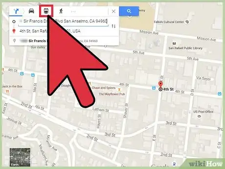
4Select Transit. Since you’re planning on taking public transit, such as a bus, click on the train or rail icon on the toolbar above the section on the upper left corner of the page. The route options for public transit will be displayed on the map identified by different colors. The metro, rail, or bus numbers will also be indicated.
-
5Indicate your bus preference. Under the starting location and destination fields on the upper left corner of the page is a “Route options” link. Click on it, and a list of route options will be presented.
- Tick on the Bus checkbox to indicate your preference on bus route options. The routes on the map will be changed to reflect your desired option.
-
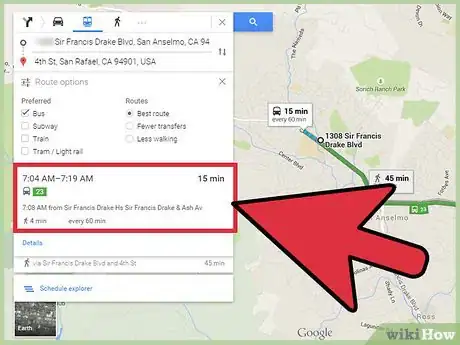
6Select a bus route. From the options presented, click on the bus route you prefer to take. The selected route will be colored. The travel duration and bus frequency will be listed on the box beside the selected route.
-
7Get directions. On the upper left corner of the page, under the preferred bus route, click on the next trip to see the exact details or directions on using that route. The left panel will be expanded to show you the Transit directions.
- All the details you need to take that bus route, such as stops, times, and walking required, will also be displayed.
Getting Bus Directions on the Google Maps Mobile App
-
1Launch Google Maps. Look for the Google Maps app on your mobile device and tap on it.
-
2Identify your destination. Use the search box on the upper left corner of the page and type in your destination location or address. A shortlist of possible results will drop down. Tap on your selection, and the map will automatically draw you to the location you’ve set.
-
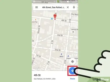
3Identify your starting location. Go back to the section on the upper left corner of the page. The destination you’ve set is displayed there. Tap on it.
- A new field will appear where you can type in your starting location or address. Tap on it and type in your location. A shortlist of possible results will drop down.
- *Tap on your selection, and you will be shown the best transportation method and route from your starting location to your destination, with the total distance and time. Most of the time this will be via car or rail, since these are the faster options.
-
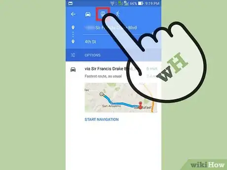
4Select Transit. Since you’re planning on taking public transit, such as a bus, tap on the train or rail icon on the toolbar above the section on the upper left corner of the page. The route options for public transit will be displayed.
-
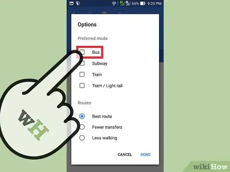
5Indicate your bus preference. Under the starting location and destination fields on the upper left corner of the page is an “Options” button. Tap on it, and a list of route options will be presented.
- Tap on the toggle button for the “Bus” option to indicate your preference on bus route options. The routes will be changed to reflect your desired option.
-
6Select a bus route. From the options presented, tap on the bus route you prefer to take. The selected route will be shown on the map.
-
7Get directions. Tap on your preferred bus route again to expand it and display more details, including the directions on using that route. All the details you need to take that bus route, such as stops, times, and walking required, will be displayed.
Community Q&A
-
QuestionHow to get a bus number in Google maps?
 Community AnswerYou cannot get a bus number, because it is not a bus scheduling program. You will have to go to the bus company's website or app.


