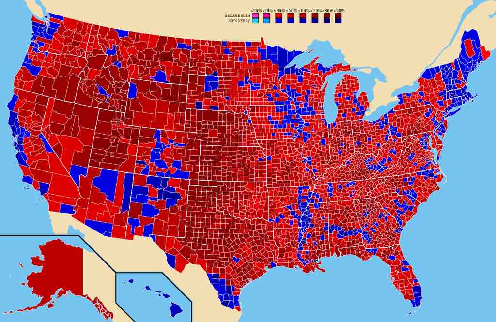
2004 Presidential Election by County
This map shows the vote in the 2004 presidential election by county. All major Republican geographic constituencies are visible: red dominates the map, showing Republican strength in the rural areas, while the denser areas (i.e., cities) are blue. Notable exceptions include the Pacific coast; New England; the Black Belt, areas with high Native American populations; and the heavily Hispanic parts of the Southwest.
Source
Boundless vets and curates high-quality, openly licensed content from around the Internet. This particular resource used the following sources:
"2004prescountymap2."
http://commons.wikimedia.org/wiki/File:2004prescountymap2.PNG
Wikimedia
CC BY.